News
‘Heavy’ snow set to hit Manchester with Met Office warning up to 20cm could fall
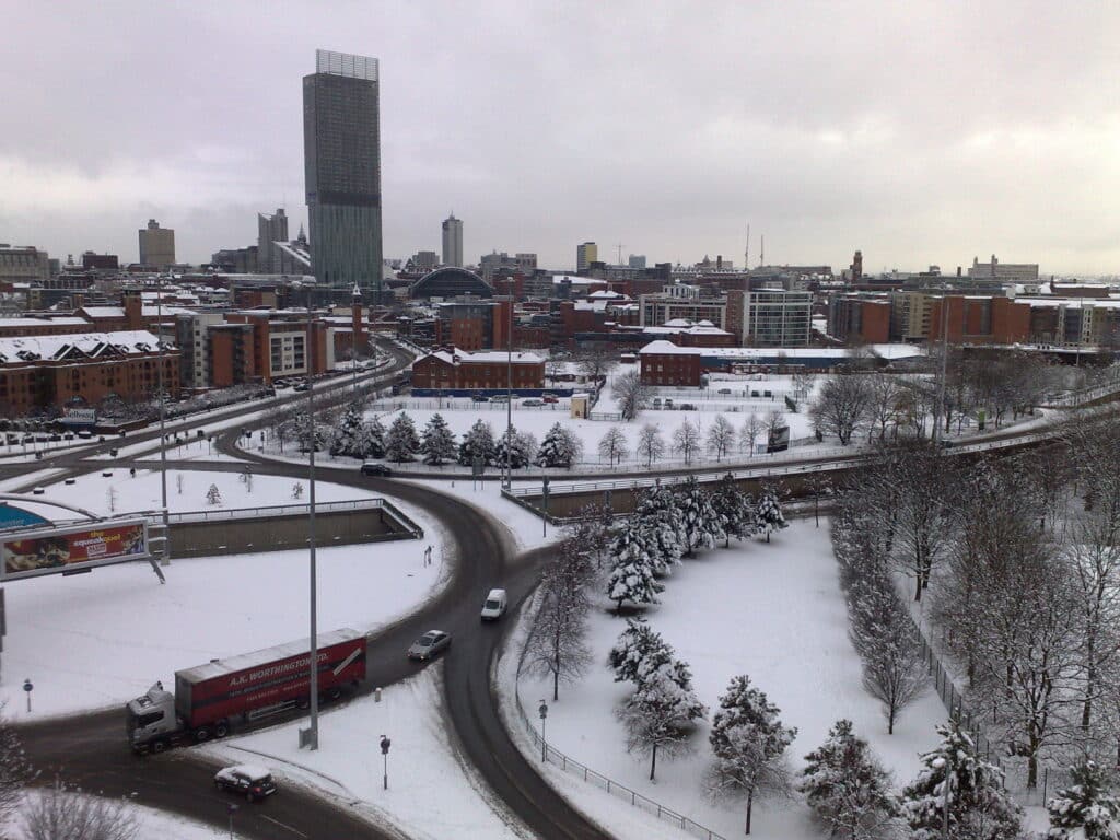
Up to 25cm of snow could fall in some places, forecasters say

Oh you thought winter was coming to an end? Well, it’s not quite done with us yet as forecasters predict ‘heavy’ snow could cover Greater Manchester from Thursday.
The Met Office says temperatures are set to plummet from tomorrow (February 7th), with a yellow weather warning for snow in place from early Thursday morning.
Cold air in from the north will bring wintry conditions that will see temperatures drop this week to below average for this time of year.
The yellow weather warning covers Northern and central England, Wales and Northern Ireland, with parts of Scotland being issued an amber warning.


The warning is currently in force from 6am on Thursday (February 8th) to 6am on Friday (February 9th).
From Thursday, there’s an increased chance of snow and ice, so be prepared for and expect the usual hazards including travel delays and power cuts, particularly for more rural areas.
Snow could fall on parts of Greater Manchester from around 7am on Thursday morning, with the white stuff easing off later in the day making way for rain (yes, more rain). The cold snap will bring a band of scattered wintry showers spreading southwards over the course of the week and reaching most parts of the UK by the weekend.
Met Office Deputy Chief Meteorologist Chris Almond said: “There’s an increased signal for wintry hazards as we move through the week as cold air from the north moves over the UK.”
He continued: “It’s from Thursday that the snow risk becomes potentially impactful, as mild air attempts to move back in from the south, bumping into the cold air and increasing the chance of snow where the two systems meet.
“While there are still lots of details to work out, the initial snow risk looks highest in northern England and Wales from Thursday.
“1-2cm is possible to low levels, with 10-20cm possible over the highest ground within the warning area. This snow is likely to gradually change to sleet and rain later on from the south.”
Warnings are likely to change throughout the week as the certainty of impacts increases, so it’s important to stay up to date with the latest Met Office forecast.
The UK Health Security Agency has Cold-Health Alerts in force for parts of England from Wednesday, highlighting the possibility of significant impacts for the health and the social care sector. Meanwhile, the National Highways has advised motorists to ‘take extra care’ and time when making a journey.
Amy Shaw, National Network Manager at National Highways, said: “Freezing conditions bring hazards such as snow and ice, so take every possible step to understand your journey in advance and allow lots of extra time when travelling to prepare for the unexpected.
“It is therefore always important to plan ahead for your journey, check the weather forecasts, and if weather conditions become challenging, adjust your driving behaviour and take extra care.”
Got a story to tell?
Have you got a story or video you think our audience will love? We want to hear from you, drop us an email on submit@propermanchester.com and we’ll get back to you.